
Quick answer
The Classic Inca Trail runs as a four-day trek from the Kilometer 82 checkpoint to Machu Picchu, crossing roughly 70,866 stone steps. Checkpoints operate 06:00–17:00 daily, and the permit fee for foreign adults is 292 PEN. Altitude, not distance, sets the pace: the two high passes shape each day far more than the raw figure does.
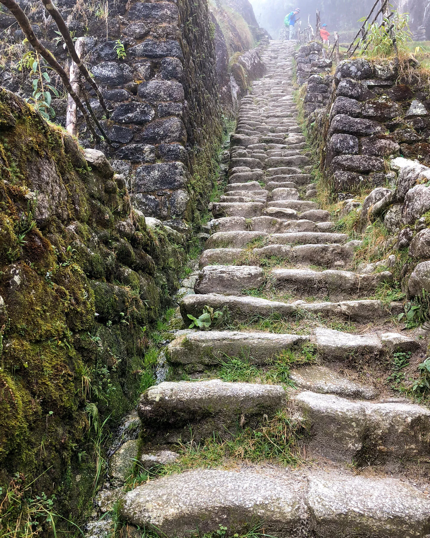
Roughly 70,866 stone steps stand between the Kilometer 82 checkpoint and the terraces of Machu Picchu. That figure explains why the inca trail hike length is a poor guide to the effort involved. The route was built as an Inca ceremonial road, part of a wider Andean network that linked Cusco to its sanctuaries, and the builders had no interest in gentle gradients. Stairways climb cloud forest ridges and drop into river valleys because the sacred geography demanded it, not because a walker would find it comfortable. In practice, the Camino Inca is a four-day, permit-controlled walk that begins at Piscacucho, in the Ollantaytambo district of Cusco. Access checkpoints operate 06:00–17:00, and the permit fee for foreign adults is 292 PEN. Numbers of trekkers are capped daily, which is why the classic Inca Trail trek distance is almost never the deciding factor in planning. Availability is. Permits are issued to named individuals and cannot be transferred, so passport details must match at the control point. Groups move at the pace of the slowest member, and porters carrying camp loads set an entirely different rhythm on the same staircases. Altitude compounds this: the same stretch feels twice as long on the climb toward Warmiwañusca. The practical response is to plan around time and acclimatisation rather than mileage. Arriving at the checkpoint between 06:00 and 09:00 brings cooler temperatures and shorter queues at the initial control points. Several days in Cusco or the Sacred Valley before departure do more for a trekker's comfort than any training focused on distance. Those who cannot secure a permit, or who want fewer nights under canvas, will find shorter itineraries that join the route later and still finish through Inti Punku, the Sun Gate. The address to remember is Kilometer 82, Piscacucho, Ollantaytambo, Cusco, Peru — the point where documents are checked and the walking actually begins. Understood properly, the inca trail hike length is a measure of days, altitude and stone rather than kilometres walked. Departure dates and permit availability are handled through the booking pages, and official permit information is published at tuboleto.cultura.pe.
“The trail is measured in days, altitude and stone rather than kilometres walked.”
Day-by-Day Classic and Short Inca Trail Hike Length
This day-by-day breakdown suits hikers comparing the 4-Day Classic Inca Trail from Km 82 (roughly 42 km / 26 miles over four days) with the 2-Day Short route from Km 104 (about 16 km / 10 miles). Both plans start at the Kilometer 82, Piscacucho, Ollantaytambo, Cusco, Peru control point, which operates 06:00–17:00 daily.
Km 82 to Wayllabamba
Classic route covers about 11 km (6.8 miles) from the Km 82 checkpoint past Patallacta to the Wayllabamba camp, typically 5–6 hours. Aim to arrive at the checkpoint between 06:00 and 09:00 for cooler temperatures and shorter queues.
Dead Woman's Pass ascent
Roughly 12 km (7.5 miles) from Wayllabamba over Warmiwañusca (Dead Woman's Pass) to Pacaymayo, 6–7 hours. This is the steepest stretch, so budget extra time above 4,000 m.
Runkurakay to Wiñay Wayna
The longest day at about 16 km (10 miles), passing Runkurakay, Sayacmarca, Phuyupatamarca and finishing at Wiñay Wayna in 8–9 hours. Most of the trail's 70,866 steps fall on this descent-heavy section.
Inti Punku and Machu Picchu
A short 5 km (3.1 miles) from Wiñay Wayna through Inti Punku to Machu Picchu, about 2 hours. Groups leave camp before dawn to reach the Sun Gate early.
Km 104 to Wiñay Wayna
The 2-day route starts at Km 104 and climbs roughly 12 km (7.5 miles) past Chachabamba and Wiñay Wayna to Machu Picchu, 7–8 hours of walking.
Machu Picchu citadel visit
About 4 km (2.5 miles) of walking within the citadel and its terraces, 2–3 hours. Permit and entry costs are set by the official ticket office at https://tuboleto.cultura.pe/.
Classic 4-Day vs. Short 2-Day Inca Trail Hike Length
Choosing between the Classic Inca Trail and the Short Inca Trail requires balancing your available travel time, physical preparation, and desired level of comfort.
|
Top pick Classic 4-Day Inca Trail Full multi-day camping trek |
Short 2-Day Inca Trail Condensed trek with hotel stay | |
|---|---|---|
| Total Distance | 43 km (26.7 miles) | 12 km (7.5 miles) |
| Days Required | 4 days | 2 days |
| Start Point | Kilometer 82 (Piscacucho) | Kilometer 104 (Chachabamba) |
| Max Altitude | 4,215 meters (13,828 feet) | 2,720 meters (8,924 feet) |
| Target Audience | Acclimatized hikers seeking a full camping experience | Travelers with limited time or moderate physical fitness |
Verdict: Select the Classic 4-Day route if you want to experience the complete high-altitude mountain trek and camping, or choose the Short 2-Day route if you prefer a lower-altitude hike that ends with a hotel stay.
The History of the Ancient Road Network Behind the Inca Trail Hike
The road came first. Long before any traveller measured the inca trail hike length in kilometres, the Inca state built the Qhapaq Ñan, the Royal Road, a network estimated at 23,000 to 45,000 kilometres reaching from Quito to central Chile. Much of it predates the Inca themselves, absorbing Wari and Chimú causeways. Under Pachacuti, who took power around 1438, and his son Túpac Inca Yupanqui, the system was consolidated with stone paving, drainage channels, retaining walls and rope suspension bridges. Chasquis, relay runners posted at tambos, carried messages along it. Cargo moved by llama train; wheels were never used. The branch now walked as the Camino Inca served Machu Picchu, the royal estate Pachacuti ordered built around 1450. It was a processional and administrative approach, not a trade artery, threading Runkurakay, Sayacmarca, Phuyupatamarca and Wiñay Wayna before reaching Inti Punku, the Sun Gate. Spanish chroniclers, among them Pedro Cieza de León in the 1550s, recorded the highland roads with open astonishment, though the estate above the Urubamba went unmentioned. Hiram Bingham, a Yale lecturer, reached Machu Picchu on 24 July 1911, guided by the farmer Melchor Arteaga. Returning in 1912 and 1915, his expeditions cleared and documented the paved route and its outlying sites, and his 1948 book fixed the corridor in the public imagination. UNESCO inscribed the sanctuary in 1983 and the Qhapaq Ñan in 2014. What survives is the road itself. Walkers on the Camino Inca trek still cross original granite paving, tunnels cut through living rock, and roughly 70866 steps of Inca stonework, with the same terraces and water channels the masons laid. The inca trail hike length is measured, finally, in surviving engineering.
Wari and Chimú road builders lay causeways later absorbed into the Inca network.
Pachacuti's accession begins the consolidation of the Qhapaq Ñan across the Andes.
Construction starts on Machu Picchu, served by the paved approach road.
Túpac Inca Yupanqui extends the royal road system toward Quito and central Chile.
Pedro Cieza de León records the Inca highland roads in his Spanish chronicles.
Hiram Bingham reaches Machu Picchu on 24 July, guided by Melchor Arteaga.
Bingham's expedition clears and documents the paved corridor and its outlying sites.
UNESCO inscribes the Qhapaq Ñan as a World Heritage Site across six countries.
Best Seasons and Timing for the Inca Trail Hike
The optimal period to hike the Inca Trail is the dry season from May to September, when rain is minimal and trail conditions are stable. Planning your daily departure between 06:00 and 09:00 ensures cooler trekking temperatures and fewer delays at the initial checkpoints.
Dry Season (May–September)
Peak volume, permits sell out earlySunny and dry, 0°C to 20°C
This period offers clear skies and the most secure trail footing. Early booking is necessary as permits are strictly limited.
February Closure
No tourist access permittedWettest month, heavy rain, 7°C to 18°C
The entire trail closes for environmental conservation, safety checks, and path maintenance. You cannot book any hikes during this month.
Daily Departures (06:00–09:00)
Lower congestion at initial checkpoints—
Entering the checkpoint within this window ensures cooler trekking temperatures and minimal delays. Early departures also help avoid the intense midday heat.
Verdict: Choose Tuesday to Thursday, starting between 06:00 and 09:00, in May or September for the best balance of clear weather and manageable crowds.
Where to Begin the Different Inca Trail Hike Length Routes
The starting points for the different Inca Trail hike length routes are situated in the Urubamba River valley of the Sacred Valley, and both are accessed via the transit hub of Ollantaytambo. The classic multi-day route begins at Kilometer 82 (Piscacucho) near the railway, whereas the shorter two-day route commences further along the railway line at Kilometer 104 (Chachabamba) near the archaeological site of the same name.
Private agency vehicle from Cusco to Kilometer 82 (Piscacucho) via Route PE-28B
PeruRail or Inca Rail service from Ollantaytambo Station to Kilometer 104 (Chachabamba) stop
Colectivo or agency minivan from Ollantaytambo to Kilometer 82 (Piscacucho)
Pre-Trek Packing Checklist for Any Inca Trail Hike Length
Whether you walk the 2-day or classic 4-day route, the same permits, documents and gear decide whether you reach the Km 82 checkpoint ready to hike.
-
Reserve your permit months ahead — Daily entry is capped and the 292 PEN Classic 4-day permit for foreign adults sells out early through licensed operators.
-
Register your passport at booking — Your permit is issued in the exact name and passport number you supply, and it cannot be changed later.
-
Carry the original passport, not a copy — Rangers check the physical document against the permit list at Kilometer 82, Piscacucho, Ollantaytambo, Cusco, Peru.
-
Bring a student card if claiming discount — The original ISIC card must be presented alongside the passport at the checkpoint.
-
Break in supportive hiking boots — Access involves roughly 70,866 steps, and new footwear causes blisters on stone stairways.
-
Pack rain shell and layers — Temperatures shift sharply between the 06:00 start and midday on exposed sections.
-
Prepare a 2-litre water system — Refill points are limited between camps, so carry capacity plus purification tablets.
-
Arrive at the checkpoint 06:00-09:00 — Cooler morning temperatures and lower congestion at the initial checkpoints; gates operate 06:00-17:00 daily.
Check availability
Frequently asked questions about inca trail hike length
Everything you need to know about inca trail hike length